Contact 4Sight to find out how GPR technology could fit into your next project.

Underground utilities don't always behave the way the records suggest. Ground Penetrating Radar (GPR) gives your team a clearer picture before work begins, so surprises stay off the job site and out of your budget.
GPR detects both conductive and non-conductive utilities, and can identify natural subsurface features including voids, groundwater, bedrock, and soil stratification. No excavation required.
Two Systems. One Team.
At 4Sight, we deploy GPR using two complementary platforms, matched to your project conditions:
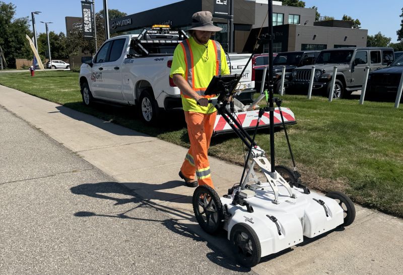
- Multi-Channel GPR (MCGPR): Tow-behind collection at driving speeds for large or linear projects, with pushcart capability for boulevards and constrained areas. Both configurations use 18/8 multi-array antennas and produce dense 3D subsurface datasets.
- Traditional Dual-Channel GPR: 400 MHz and 800 MHz antennas provide depth and resolution in one pass. Anomalies are marked on the ground and integrated with survey data.
Where We Apply It
- Utility Mapping
- Concrete Inspections
- Soil Void Detection
- Environmental Assessments
- Archaeological Surveys
Ready to find out more?
Contact
P: 1 (289) 385-3303
E: info@4SightUE.com
Address
Headquarters
4Sight Head Office
2100 Forbes Street, Unit 1
Whitby, ON
L1N 9T3
126 Market Street
Commercial Unit #1
Philadelphia,
PA 19106
© 2026 All Rights Reserved | Contact Us | Accessibility | Privacy Policy | Terms of Use
