If you're ready to learn more about how SUE could be applied to your next project then contact 4Sight today.

4Sight is an industry leader in providing high-quality Subsurface Utility Engineering (SUE) services, backed by decades of experience and a team that helped develop the ASCE 38-22 standard. SUE focuses on the accurate mapping, location, and characterization of underground utilities, including water, sewer, gas, electrical, and telecommunications infrastructure.
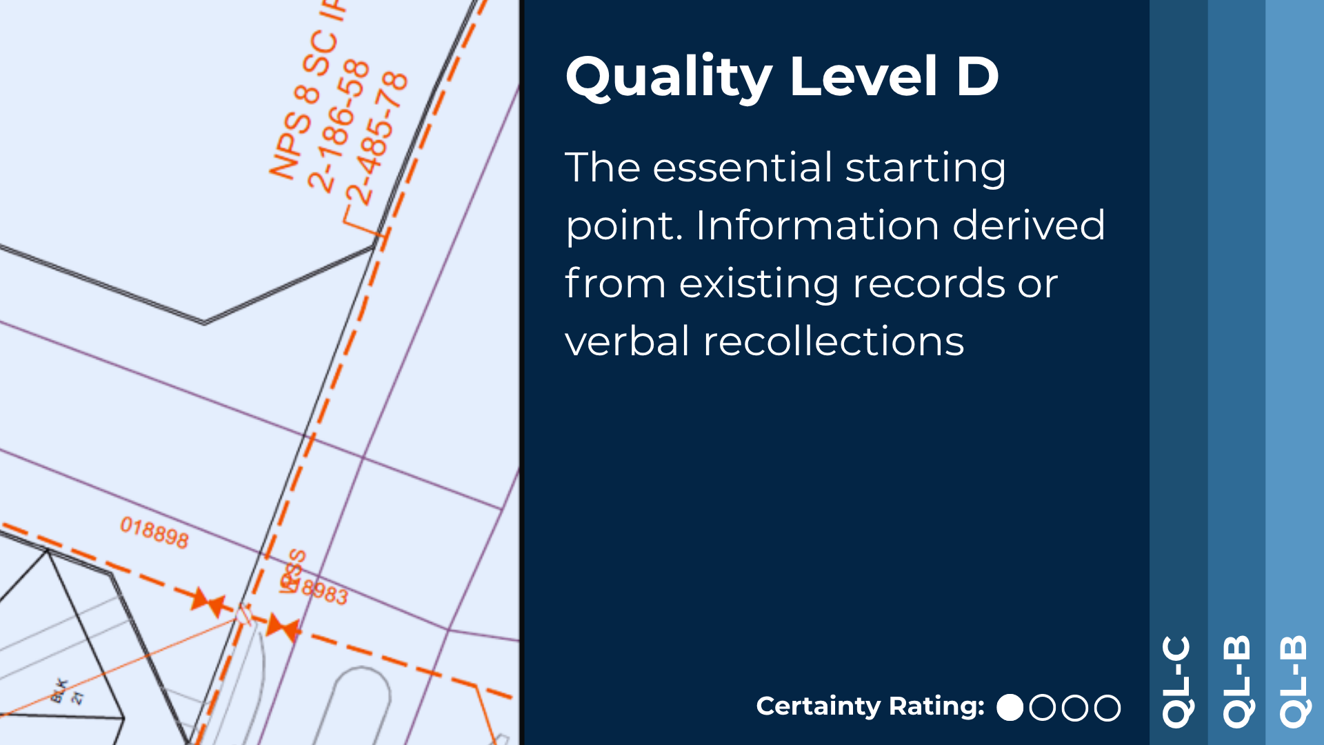
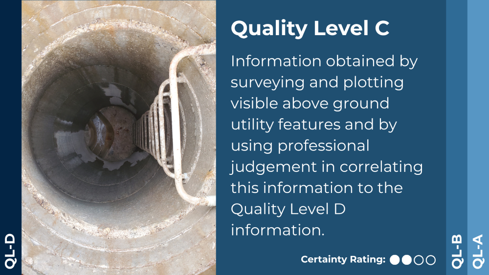
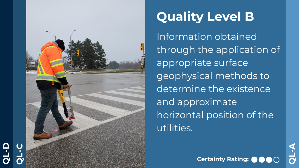
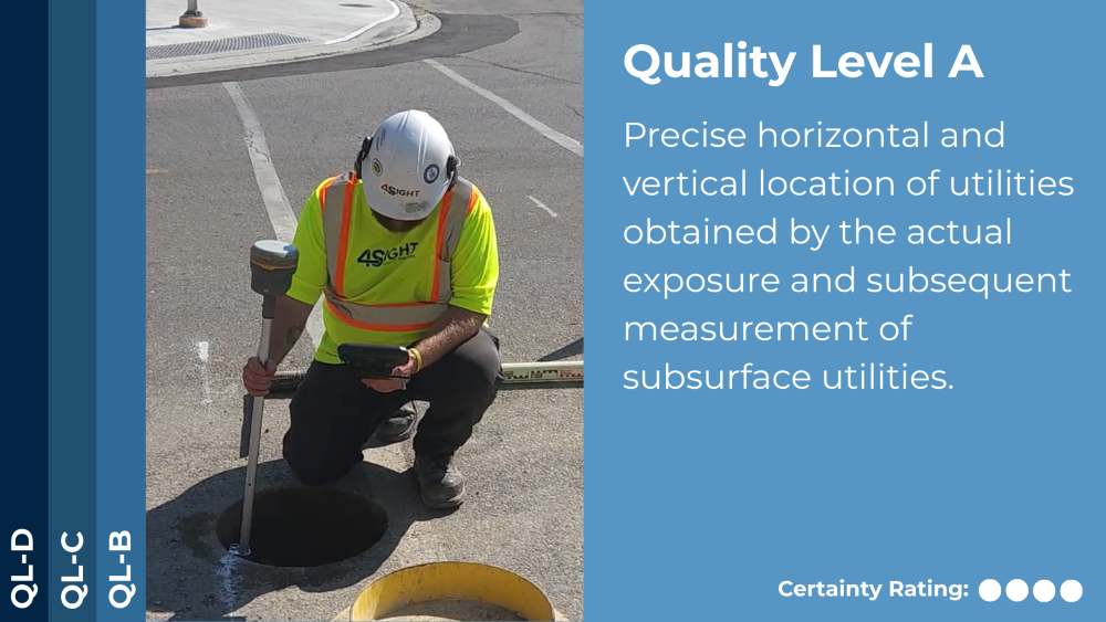
ASCE Quality Levels
The practice of SUE follows the ASCE 38 Standard, which defines four quality levels to ensure reliable and consistent utility data.
Each of these levels has a role and helps to support different project decisions. Understanding which level is right for your project requires both expertise and experience, and that's where 4Sight stands apart. We didn't just learn these standards; we helped shape them.
 Deliverables
All SUE deliverables are prepared in accordance with ASCE 38 standards and reviewed and signed by a Professional Engineer. Utility alignments on project drawings are clearly labeled with their respective Quality Levels, accompanied by detailed notes highlighting chamber structures, key field findings, and any conflicts with existing utility records. A comprehensive project report summarizes the investigation scope, equipment used, significant findings, and recommendations, providing clients with actionable insights for informed project planning and risk mitigation.
SUE Investigation Methods
To deliver precise subsurface information, 4Sight employs a variety of advanced investigation techniques tailored to project needs, including:
Aerial Measurements
Capturing surface and utility features from above for context and planning.
Closed-Circuit Television (CCTV) & Sonar
Inspecting the interior of pipelines and sewer systems.
Designating
Identifying the location of buried utilities.
Ground-Penetrating Radar (GPR)
Identifying both metallic and non-metallic subsurface utilities.
LiDAR
Creating high-resolution, 3D representations of site conditions.
Vacuum Excavation
Safely exposing underground utilities to verify locations without damaging infrastructure.
Ready to find out more?
| Key Questions when scoping a project |
|---|
Our Projects

Utilities – Toronto Western Hospital WET Project
Owner: Noventa Energy Client: Bird Construction Project: TWH – Wastewater Energy Transfer Project Description: Noventa is building a Wastewater Energy Transfer System that will […]

Government – Darlington SMR Project
Owner: Ontario Power Generation Client: ES Fox Project: Small Modular Reactor Project – Darlington Description: Ontario Power Generation (OPG) is planning and licensing four […]

Developer – Barrington Development
Owner: Crombie REIT Client: Crombie REIT / Halifax Water Project: Sewer Mapping – Barrington Residential Development Halifax Description: The goal of the investigation was to […]

Government – Hwy 401 Expansion
Owner: Ontario Ministry of Transportation Client: AECOM Project: Hwy 401 Expansion – Victoria Park to Neilson Rd Description: The MTO Highway 401 expansion project from Victoria […]

Utilities – West Toronto Tower Relocation
Owner: Hydro One Client: Gannet Fleming Project: HONI – West Toronto Tower Relocation Project Description: The Hydro One and Metrolinx West Toronto Transmission Tower Relocation Project […]

Institutions – Royal Ontario Museum
Owner: Infrastructure Ontario Client: Colliers Project: ROM Upgrades Description: The Royal Ontario Museum (ROM) Redevelopment project, known as OpenROM, involves a $130 million transformation […]

Developers – Innovia – Toronto Rail Deck
Innovia Project: Toronto Rail Deck Toronto Rail Deck Owner: Innovia Client: Innovia Project: Toronto Rail Deck Description: The Innovia Toronto Rail Deck Development is a […]

Developers – Sorbora – Baldwin and Columbus
Owner: Sorbora Development Group Client: SCS Consulting Group Project: Baldwin and Columbus Description: The Brooklin Trails community by Sorbara Development Group in Brooklin, Ontario, […]

Developers – Bental Green Oak – 100 Simcoe
Owner: Bentall Green Oak Client: Bentall Green Oak Project: 100 Simcoe – Toronto Description: The Bentall GreenOak development at 100 Simcoe Street in Toronto […]

Developers – UC Tower 2
Owner: Tribute Homes Client: Tribute Homes Project: UC Tower 2 Description: The Tribute Homes UC Tower 2 project in Oshawa is a […]
Contact
P: 1 (289) 385-3303
E: info@4SightUE.com
Address
Headquarters
4Sight Head Office
2100 Forbes Street, Unit 1
Whitby, ON
L1N 9T3
126 Market Street
Commercial Unit #1
Philadelphia,
PA 19106
© 2026 All Rights Reserved | Contact Us | Accessibility | Privacy Policy | Terms of Use
